Authors: Manuel Mendoza-Hurtado, Juan A. Romero-del-Castillo and Domingo Ortiz-Boyer
Overview
Mobile-phone network data provide valuable information about the temporal activity and functional structure of urban and regional areas. However, conventional place-identification and clustering methods usually assign a single category—such as residential or work—to each location. This representation oversimplifies mixed-use urban environments, where several functions may coexist within the same spatial unit.
Our published study introduces MAPLID: Multi-label Approach for Place IDentification, a supervised multi-label framework that uses aggregated Call Detail Records (CDRs) supplied by mobile network operators to assign several concurrent labels to each area. Rather than forcing each grid cell into one exclusive category, MAPLID can describe it simultaneously according to its functional and morphological characteristics.
Methodology
The principal case study uses anonymised and aggregated CDR data from Telecom Italia for the city of Milan. These data record the volume of incoming and outgoing calls, incoming and outgoing SMS messages, and internet activity in regular temporal intervals across a spatial grid.
A representative 20 × 20 subgrid was manually annotated with five labels:
- home;
- work;
- high population or building density;
- medium density;
- low density.
The home and work categories are not mutually exclusive, since a grid cell can contain both residential and employment-related functions. By contrast, the three density categories describe alternative levels of urban morphology.
Four established multi-label classification approaches were evaluated:
- Binary Relevance;
- Label Powerset;
- Classifier Chains;
- Multi-Label k-Nearest Neighbours.
The models were evaluated through iterative-stratified 10-fold cross-validation using nine complementary classification and ranking measures, including accuracy, Hamming loss, F1-score, average precision, coverage and ranking loss.
Main results
The experiments confirmed that a multi-label formulation can represent the functional complexity of urban areas more effectively than approaches that assign only one category to each cell.
The best overall configuration was obtained with Label Powerset using Random Forest as its base classifier and outgoing-call activity as input. This configuration achieved 88.3% average precision and produced the best result in four of the nine evaluation measures considered.
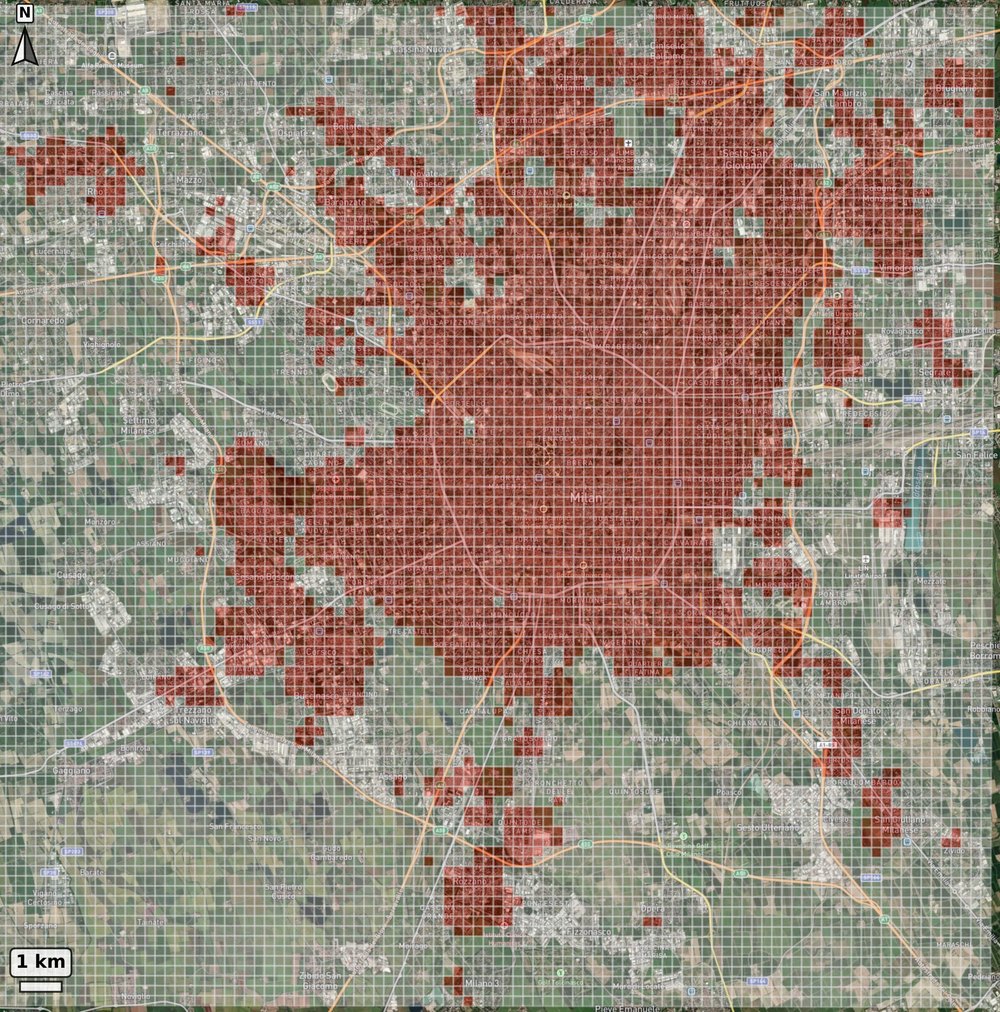
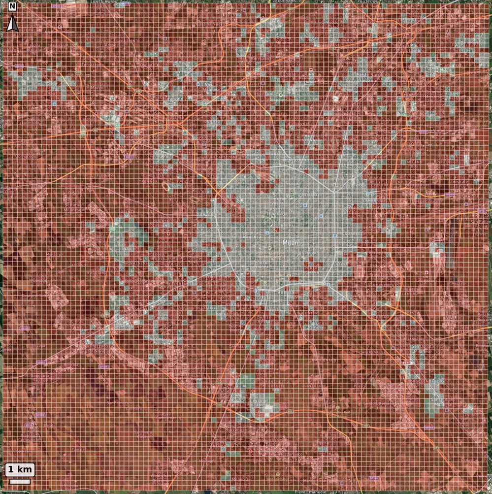
After model evaluation, the selected classifier was trained on the annotated subgrid and applied to the complete Milan grid. The resulting maps provide separate predictions for each label, enabling cells to be represented as residential, work-related or both, together with their estimated density category.
These outputs should be interpreted as area-level functional proxy maps derived from aggregate telecommunications activity. They do not identify the precise home or workplace of individual mobile-phone users.
Evaluation in Trento and integration of POI data
MAPLID was also evaluated in the Province of Trento to determine whether the methodology remained effective in a substantially different geographical context. In contrast with metropolitan Milan, Trento contains lower-density settlements, irregular Alpine terrain and extensive forested areas.
The Trento experiments confirmed that the framework can be applied beyond a dense metropolitan environment when a representative local training area is available. The study therefore provides evidence of applicability across contrasting contexts within the Telecom Italia dataset, although evaluation with other operators and countries would still be required to establish broader transferability.
The study additionally examined whether Point of Interest information extracted from OpenStreetMap could complement the CDR activity features. POI integration had only a limited effect in the information-rich Milan case but produced clearer improvements in Trento, increasing classification accuracy and reducing ranking loss. This indicates that contextual geographic data are particularly valuable in areas where telecommunications activity is sparse or less discriminative.
Conclusions
MAPLID provides a computationally efficient and interpretable framework for identifying multiple concurrent urban functions from mobile-phone network data. Its main contribution is to represent mixed-use areas explicitly, rather than forcing each location into a single functional category.
The methodology can support applications such as:
- urban and regional functional mapping;
- identification of residential, employment and mixed-use areas;
- analysis of urban density and activity patterns;
- transport and infrastructure planning;
- service allocation;
- comparison of urban and rural spatial structures.
The research was published in the International Journal of Geographical Information Science in 2026.