Authors: Manuel Mendoza-Hurtado, Juan A. Romero-del-Castillo and Domingo Ortiz-Boyer
Abstract
Mobile-phone network data provide valuable information about the spatial and temporal distribution of population activity. These data can support the identification of meaningful urban areas, such as residential and employment zones, but most previous studies have relied on unsupervised clustering methods.
This study introduces SAMPLID—Supervised Approach for Meaningful Place Identification, a methodology that addresses place identification as a supervised classification problem. Instead of allowing an unsupervised algorithm to form groups solely according to similarities in mobile activity, SAMPLID uses a representative set of manually labelled spatial units to train a classifier for the specific categories that need to be identified.
The methodology was evaluated using anonymised and aggregated Call Detail Record data from the city of Milan. The dataset contains activity associated with incoming and outgoing calls, incoming and outgoing SMS messages, and internet connections, represented in a regular 100 × 100 spatial grid.
Two sampling strategies were investigated to construct the labelled training set:
- a contiguous 20 × 20 subgrid containing clearly differentiated residential and employment areas;
- a set of 250 randomly selected cells.
The labelled data were used to train a k-nearest neighbours classifier, and its performance was compared with two classical unsupervised clustering algorithms: k-means and k-medoids.
Main results
The supervised SAMPLID approach consistently outperformed the clustering alternatives in identifying residential and work-related areas.
The best result was obtained using:
- the contiguous 20 × 20 labelled subgrid;
- outgoing-call activity from one working day;
- a k-nearest neighbours classifier with (k = 10).
This configuration achieved an accuracy of 78.5%.
The contiguous subgrid generally produced better results than the randomly selected cells. This suggests that a geographically coherent training region provides useful information about transitions and boundaries between areas with different functions.
Combining the contiguous and random samples did not improve performance, indicating that the representativeness and spatial coherence of the labelled data may be more important than simply increasing the number of training cells.
The best k-medoids configuration reached an accuracy of 74.0%, while k-means generally performed less effectively. Although clustering identified patterns in the distribution of mobile-phone activity, the resulting clusters did not always correspond to the semantic categories of interest, namely residential and work-related areas.
Full-grid prediction
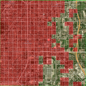
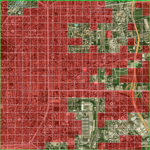
After evaluating the model on the manually labelled cells, the best-performing SAMPLID configuration was trained using the 20 × 20 subgrid and applied to the complete Milan grid.
The resulting map provides an area-level prediction of residential and work-related functions across the city. These predictions should be interpreted as functional proxies derived from aggregated telecommunications activity rather than as the precise home or workplace locations of individual mobile-phone users.
The results show that supervised learning can transform a relatively small amount of expert-labelled data into a functional classification of a much larger urban area.
Conclusions
SAMPLID demonstrates that meaningful-place identification can be addressed effectively through supervised learning rather than relying exclusively on unsupervised clustering.
Its principal advantages are:
- the classification categories are explicitly aligned with the purpose of the analysis;
- expert knowledge can be incorporated through the labelled training sample;
- the model can be quantitatively evaluated before being applied to unlabelled areas;
- the approach remains simple, interpretable and computationally efficient;
- the methodology can be extended to other functional categories and geographical contexts.
The study also established the basis for subsequent research on multi-label place identification, in which each spatial unit can simultaneously represent several functions, such as residential and employment activity.
Publication
Mendoza-Hurtado, M., Romero-del-Castillo, J. A., and Ortiz-Boyer, D. (2024). “SAMPLID: A New Supervised Approach for Meaningful Place Identification Using Call Detail Records as an Alternative to Classical Unsupervised Clustering Techniques”. ISPRS International Journal of Geo-Information, 13(8), 289.
https://doi.org/10.3390/ijgi13080289